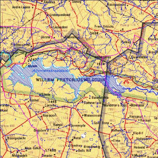
C4R001Q01
Rivs: Duplooyspruit Rietspruit Sand
28o18'12.3"S 27o14'22"E
(-28.30343, 27.239447)
Map 2827AC 2827AD
21338m wide x 8782m high
Cape Datum.
Surveys and Mapping.
Data from file
/iwqs3/tmp/dams/tmp/wla500-geo
| Allemanskraal (reservoir) | ||
|---|---|---|
|
|
|
|
|
Allemanskraal C4R001Q01 Rivs: Duplooyspruit Rietspruit Sand |
||
|
Locality: 28o18'12.3"S 27o14'22"E (-28.30343, 27.239447) Map 2827AC 2827AD 21338m wide x 8782m high Cape Datum. |
||
|
Surveys and Mapping. Data from file /iwqs3/tmp/dams/tmp/wla500-geo |
||
| <--Previous | Home^ | Next--> | |
| Resource Quality Services | stmaphtml.aml 2004-05-21 - 07:43:51 | |