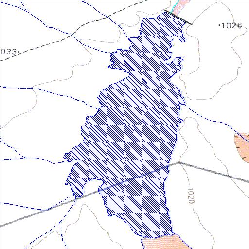
Rivs: Rooivlak_se_Laagte
31o25'04.3"S 20o13'19.9"E
(-31.417864, 20.222206)
Map 3120AC
1534m wide x 3097m high
Cape Datum.
Surveys and Mapping.
Data from file
/iwqs3/tmp/dams/tmp/wla500-geo
| Brakfontein541 (reservoir) | ||
|---|---|---|
|
|
|
|
|
Brakfontein541 Rivs: Rooivlak_se_Laagte |
||
|
Locality: 31o25'04.3"S 20o13'19.9"E (-31.417864, 20.222206) Map 3120AC 1534m wide x 3097m high Cape Datum. |
||
|
Surveys and Mapping. Data from file /iwqs3/tmp/dams/tmp/wla500-geo |
||
| <--Previous | Home^ | Next--> | |
| Resource Quality Services | stmaphtml.aml 2004-05-21 - 08:15:23 | |