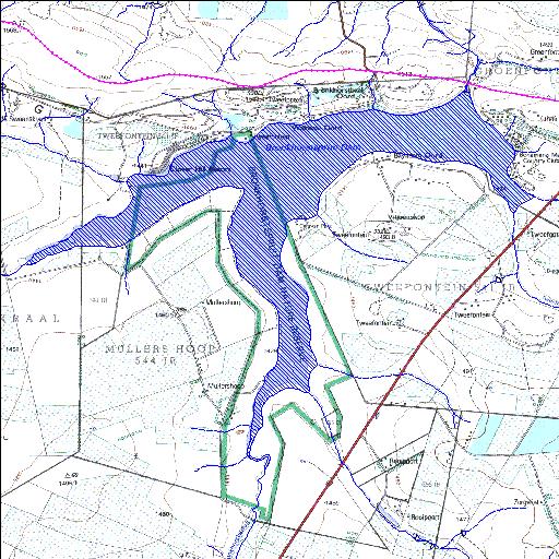
B2R001Q01
Rivs: Bronkhorstspruit Osspruit
25o54'56"S 28o41'36.7"E
(-25.91555, 28.693533)
Map 2528DC
8549m wide x 7291m high
Cape Datum.
Surveys and Mapping.
Data from file
/iwqs3/tmp/dams/tmp/wla500-geo
| Bronkhorstspruit (reservoir) | ||
|---|---|---|
|
|
|
|
|
Bronkhorstspruit B2R001Q01 Rivs: Bronkhorstspruit Osspruit |
||
|
Locality: 25o54'56"S 28o41'36.7"E (-25.91555, 28.693533) Map 2528DC 8549m wide x 7291m high Cape Datum. |
||
|
Surveys and Mapping. Data from file /iwqs3/tmp/dams/tmp/wla500-geo |
||
| <--Previous | Home^ | Next--> | |
| Resource Quality Services | stmaphtml.aml 2004-05-21 - 08:18:59 | |