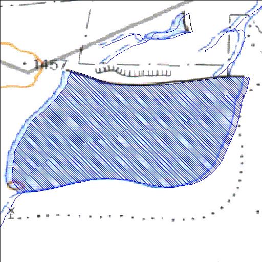
Rivs: _
31o22'51.5"S 24o34'11.1"E
(-31.380963, 24.569741)
Map 3124BC
1391m wide x 907m high
Cape Datum.
Surveys and Mapping.
Data from file
/iwqs3/tmp/dams/tmp/wla500-geo
| Colletskraal131 (reservoir) | ||
|---|---|---|
|
|
|
|
|
Colletskraal131 Rivs: _ |
||
|
Locality: 31o22'51.5"S 24o34'11.1"E (-31.380963, 24.569741) Map 3124BC 1391m wide x 907m high Cape Datum. |
||
|
Surveys and Mapping. Data from file /iwqs3/tmp/dams/tmp/wla500-geo |
||
| <--Previous | Home^ | Next--> | |
| Resource Quality Services | stmaphtml.aml 2004-05-21 - 08:36:44 | |