Rivs: _
32o52'41.5"S 19o19'33.1"E
(-32.878183, 19.32585)
Map 3219CD
1223m wide x 1442m high
Cape Datum.
Surveys and Mapping.
Data from file
/iwqs3/tmp/dams/tmp/wla500-geo
| Demeul427 (reservoir) | ||
|---|---|---|
|
|
|
|
|
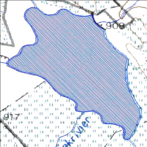
Demeul427 Rivs: _ |
||
|
Locality: 32o52'41.5"S 19o19'33.1"E (-32.878183, 19.32585) Map 3219CD 1223m wide x 1442m high Cape Datum. |
||
|
Surveys and Mapping. Data from file /iwqs3/tmp/dams/tmp/wla500-geo |
||
| <--Previous | Home^ | Next--> | |
| Resource Quality Services | stmaphtml.aml 2004-05-21 - 08:47:34 | |