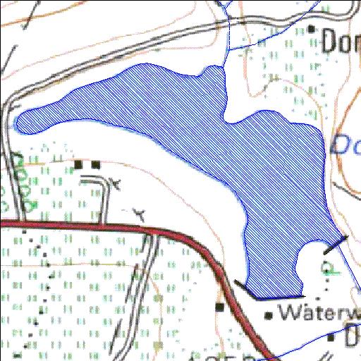
A6R003Q01
Rivs: Little_Nyl
24o39'59.2"S 28o19'07"E
(-24.666435, 28.318622)
Map 2428CB
1246m wide x 1020m high
Cape Datum.
Surveys and Mapping.
Data from file
/iwqs3/tmp/dams/tmp/wla500-geo
| Donkerpoort (reservoir) | ||
|---|---|---|
|
|
|
|
|
Donkerpoort A6R003Q01 Rivs: Little_Nyl |
||
|
Locality: 24o39'59.2"S 28o19'07"E (-24.666435, 28.318622) Map 2428CB 1246m wide x 1020m high Cape Datum. |
||
|
Surveys and Mapping. Data from file /iwqs3/tmp/dams/tmp/wla500-geo |
||
| <--Previous | Home^ | Next--> | |
| Resource Quality Services | stmaphtml.aml 2004-05-21 - 08:49:34 | |