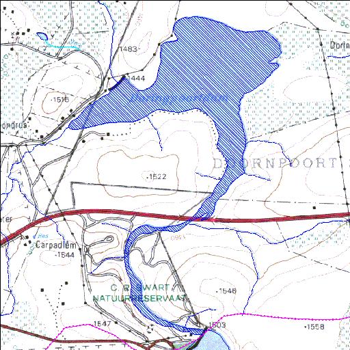
Rivs: Olifants
25o52'24.1"S 29o18'08.3"E
(-25.873374, 29.302318)
Map 2529CD
2731m wide x 4349m high
Cape Datum.
Surveys and Mapping.
Data from file
/iwqs3/tmp/dams/tmp/wla500-geo
| Doringpoort (reservoir) | ||
|---|---|---|
|
|
|
|
|
Doringpoort Rivs: Olifants |
||
|
Locality: 25o52'24.1"S 29o18'08.3"E (-25.873374, 29.302318) Map 2529CD 2731m wide x 4349m high Cape Datum. |
||
|
Surveys and Mapping. Data from file /iwqs3/tmp/dams/tmp/wla500-geo |
||
| <--Previous | Home^ | Next--> | |
| Resource Quality Services | stmaphtml.aml 2004-05-21 - 08:52:18 | |