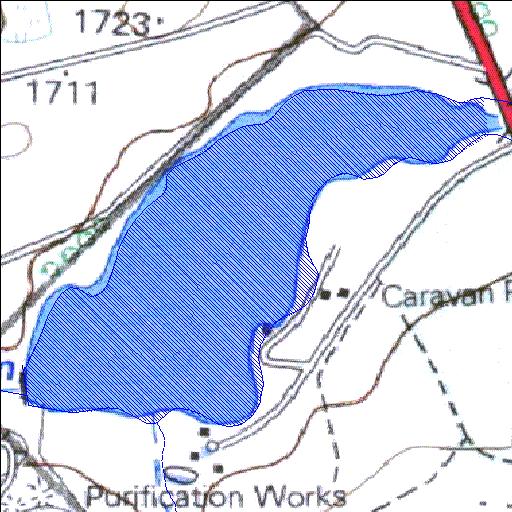
Rivs: _
26o28'05.9"S 29o56'51.1"E
(-26.468299, 29.947515)
Map 2629BD
1371m wide x 1145m high
Cape Datum.
Surveys and Mapping.
Data from file
/iwqs3/tmp/dams/tmp/wla500-geo
| Douglas C11F (reservoir) | ||
|---|---|---|
|
|
|
|
|
Douglas C11F Rivs: _ |
||
|
Locality: 26o28'05.9"S 29o56'51.1"E (-26.468299, 29.947515) Map 2629BD 1371m wide x 1145m high Cape Datum. |
||
|
Surveys and Mapping. Data from file /iwqs3/tmp/dams/tmp/wla500-geo |
||
| <--Previous | Home^ | Next--> | |
| Resource Quality Services | stmaphtml.aml 2004-05-21 - 08:54:38 | |