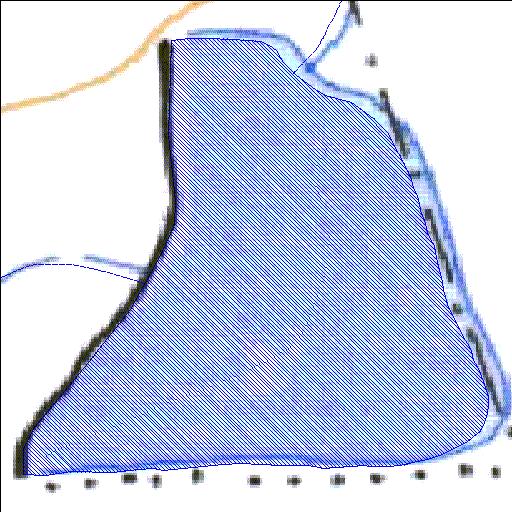
Rivs: _
31o51'58.5"S 23o53'18.7"E
(-31.866243, 23.888522)
Map 3123DD
698m wide x 777m high
Cape Datum.
Surveys and Mapping.
Data from file
/iwqs3/tmp/dams/tmp/wla500-geo
| Driefontein026 (reservoir) | ||
|---|---|---|
|
|
|
|
|
Driefontein026 Rivs: _ |
||
|
Locality: 31o51'58.5"S 23o53'18.7"E (-31.866243, 23.888522) Map 3123DD 698m wide x 777m high Cape Datum. |
||
|
Surveys and Mapping. Data from file /iwqs3/tmp/dams/tmp/wla500-geo |
||
| <--Previous | Home^ | Next--> | |
| Resource Quality Services | stmaphtml.aml 2004-05-21 - 08:56:49 | |