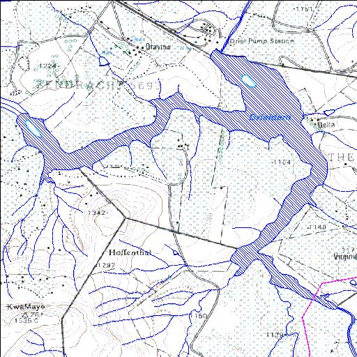
V1R002Q01
alias Driel
Rivs: Mlambonja Thukela
28o46'48.9"S 29o17'09.2"E
(-28.780259, 29.285886)
Map 2829CD
4647m wide x 4357m high
Cape Datum.
Surveys and Mapping.
Data from file
/iwqs3/tmp/dams/tmp/wla500-geo
| Driel Barrage (reservoir) | ||
|---|---|---|
|
|
|
|
|
Driel Barrage V1R002Q01 alias Driel Rivs: Mlambonja Thukela |
||
|
Locality: 28o46'48.9"S 29o17'09.2"E (-28.780259, 29.285886) Map 2829CD 4647m wide x 4357m high Cape Datum. |
||
|
Surveys and Mapping. Data from file /iwqs3/tmp/dams/tmp/wla500-geo |
||
| <--Previous | Home^ | Next--> | |
| Resource Quality Services | stmaphtml.aml 2004-05-21 - 08:59:33 | |