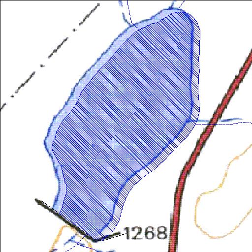
Rivs: _
31o41'09.8"S 22o50'42.8"E
(-31.686063, 22.845215)
Map 3122DB
739m wide x 1277m high
Cape Datum.
Surveys and Mapping.
Data from file
/iwqs3/tmp/dams/tmp/wla500-geo
| Drupfontein208 (reservoir) | ||
|---|---|---|
|
|
|
|
|
Drupfontein208 Rivs: _ |
||
|
Locality: 31o41'09.8"S 22o50'42.8"E (-31.686063, 22.845215) Map 3122DB 739m wide x 1277m high Cape Datum. |
||
|
Surveys and Mapping. Data from file /iwqs3/tmp/dams/tmp/wla500-geo |
||
| <--Previous | Home^ | Next--> | |
| Resource Quality Services | stmaphtml.aml 2004-05-21 - 09:01:55 | |