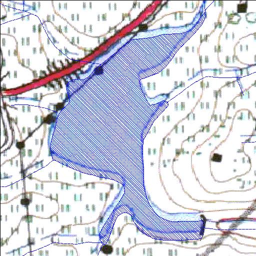
Rivs: _
30o19'14.4"S 30o40'07.1"E
(-30.32066, 30.668638)
Map 3030BC
611m wide x 1013m high
Cape Datum.
Surveys and Mapping.
Data from file
/iwqs3/tmp/dams/tmp/wla500-geo
| EJ Smith (reservoir) | ||
|---|---|---|
|
|
|
|
|
EJ Smith Rivs: _ |
||
|
Locality: 30o19'14.4"S 30o40'07.1"E (-30.32066, 30.668638) Map 3030BC 611m wide x 1013m high Cape Datum. |
||
|
Surveys and Mapping. Data from file /iwqs3/tmp/dams/tmp/wla500-geo |
||
| <--Previous | Home^ | Next--> | |
| Resource Quality Services | stmaphtml.aml 2004-05-21 - 09:04:51 | |