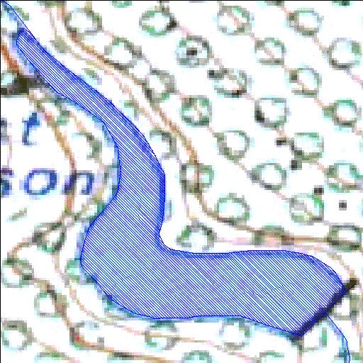
K2R001Q01
Rivs: _
33o53'59.6"S 22o10'22.1"E
(-33.899876, 22.172792)
Map 3322CC
486m wide x 552m high
Cape Datum.
Surveys and Mapping.
Data from file
/iwqs3/tmp/dams/tmp/wla500-geo
| Ernest Robertson (reservoir) | ||
|---|---|---|
|
|
|
|
|
Ernest Robertson K2R001Q01 Rivs: _ |
||
|
Locality: 33o53'59.6"S 22o10'22.1"E (-33.899876, 22.172792) Map 3322CC 486m wide x 552m high Cape Datum. |
||
|
Surveys and Mapping. Data from file /iwqs3/tmp/dams/tmp/wla500-geo |
||
| <--Previous | Home^ | Next--> | |
| Resource Quality Services | stmaphtml.aml 2004-05-21 - 09:12:58 | |