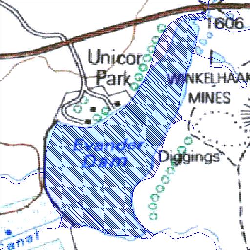
Rivs: _
26o29'25.4"S 29o07'42.6"E
(-26.490393, 29.128497)
Map 2629AC
966m wide x 1467m high
Cape Datum.
Surveys and Mapping.
Data from file
/iwqs3/tmp/dams/tmp/wla500-geo
| Evander (reservoir) | ||
|---|---|---|
|
|
|
|
|
Evander Rivs: _ |
||
|
Locality: 26o29'25.4"S 29o07'42.6"E (-26.490393, 29.128497) Map 2629AC 966m wide x 1467m high Cape Datum. |
||
|
Surveys and Mapping. Data from file /iwqs3/tmp/dams/tmp/wla500-geo |
||
| <--Previous | Home^ | Next--> | |
| Resource Quality Services | stmaphtml.aml 2004-05-21 - 09:15:43 | |