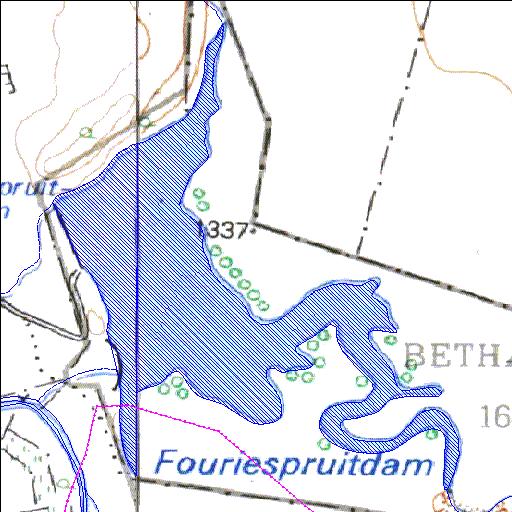
Rivs: Fouriespruit
29o39'38.7"S 26o00'17"E
(-29.660761, 26.004726)
Map 2925DB 2926CA
1718m wide x 2233m high
Cape Datum.
Surveys and Mapping.
Data from file
/iwqs3/tmp/dams/tmp/wla500-geo
| Fouriespruit (reservoir) | ||
|---|---|---|
|
|
|
|
|
Fouriespruit Rivs: Fouriespruit |
||
|
Locality: 29o39'38.7"S 26o00'17"E (-29.660761, 26.004726) Map 2925DB 2926CA 1718m wide x 2233m high Cape Datum. |
||
|
Surveys and Mapping. Data from file /iwqs3/tmp/dams/tmp/wla500-geo |
||
| <--Previous | Home^ | Next--> | |
| Resource Quality Services | stmaphtml.aml 2004-05-21 - 09:22:36 | |