Rivs: _
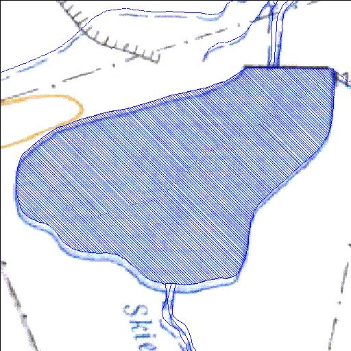
31o43'46.8"S 23o24'03.4"E
(-31.729678, 23.400936)
Map 3123CB
1162m wide x 972m high
Cape Datum.
Surveys and Mapping.
Data from file
/iwqs3/tmp/dams/tmp/wla500-geo
| Gabrielsbake2 (reservoir) | ||
|---|---|---|
|
|
|
|
|
Gabrielsbake2 Rivs: _ |
||
|
Locality: 31o43'46.8"S 23o24'03.4"E (-31.729678, 23.400936) Map 3123CB 1162m wide x 972m high Cape Datum. |
||
|
Surveys and Mapping. Data from file /iwqs3/tmp/dams/tmp/wla500-geo |
||
| <--Previous | Home^ | Next--> | |
| Resource Quality Services | stmaphtml.aml 2004-05-21 - 09:24:30 | |