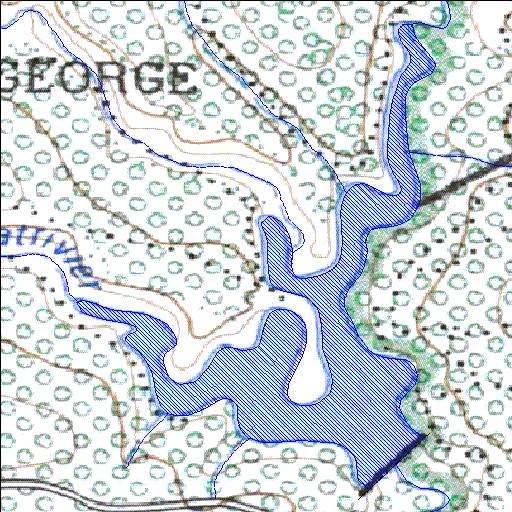
K3R002Q01
alias Tuinroete
Rivs: Swart
33o57'28.5"S 22o30'38"E
(-33.95793, 22.510568)
Map 3322DC
1068m wide x 1625m high
Cape Datum.
Surveys and Mapping.
Data from file
/iwqs3/tmp/dams/tmp/wla500-geo
| Garden Route (reservoir) | ||
|---|---|---|
|
|
|
|
|
Garden Route K3R002Q01 alias Tuinroete Rivs: Swart |
||
|
Locality: 33o57'28.5"S 22o30'38"E (-33.95793, 22.510568) Map 3322DC 1068m wide x 1625m high Cape Datum. |
||
|
Surveys and Mapping. Data from file /iwqs3/tmp/dams/tmp/wla500-geo |
||
| <--Previous | Home^ | Next--> | |
| Resource Quality Services | stmaphtml.aml 2004-05-21 - 09:27:36 | |