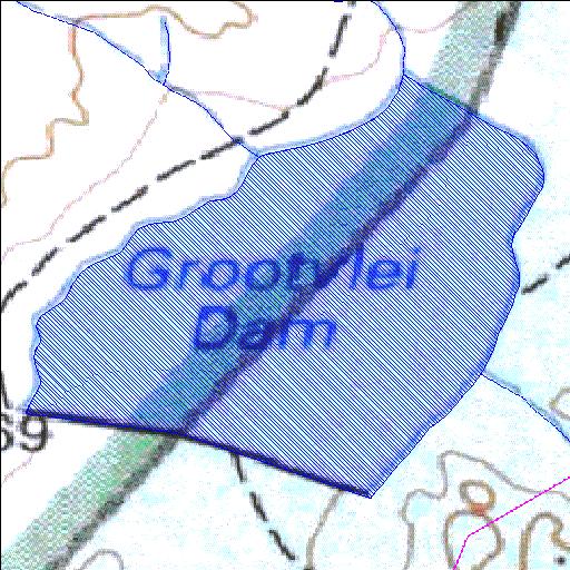
alias Peninsula
Rivs: _
34o10'38.6"S 18o58'37.4"E
(-34.177401, 18.977049)
Map 3418BB
872m wide x 880m high
Cape Datum.
Surveys and Mapping.
Data from file
/iwqs3/tmp/dams/tmp/wla500-geo
| Grootvlei G (reservoir) | ||
|---|---|---|
|
|
|
|
|
Grootvlei G alias Peninsula Rivs: _ |
||
|
Locality: 34o10'38.6"S 18o58'37.4"E (-34.177401, 18.977049) Map 3418BB 872m wide x 880m high Cape Datum. |
||
|
Surveys and Mapping. Data from file /iwqs3/tmp/dams/tmp/wla500-geo |
||
| <--Previous | Home^ | Next--> | |
| Resource Quality Services | stmaphtml.aml 2004-05-21 - 09:44:47 | |