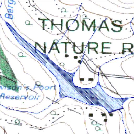
P3R001Q01
Rivs: Palmiet
33o23'00.1"S 26o28'56.5"E
(-33.38336, 26.482368)
Map 3326AD
1212m wide x 1113m high
Cape Datum.
Surveys and Mapping.
Data from file
/iwqs3/tmp/dams/tmp/wla500-geo
| Howisons Poort (reservoir) | ||
|---|---|---|
|
|
|
|
|
Howisons Poort P3R001Q01 Rivs: Palmiet |
||
|
Locality: 33o23'00.1"S 26o28'56.5"E (-33.38336, 26.482368) Map 3326AD 1212m wide x 1113m high Cape Datum. |
||
|
Surveys and Mapping. Data from file /iwqs3/tmp/dams/tmp/wla500-geo |
||
| <--Previous | Home^ | Next--> | |
| Resource Quality Services | stmaphtml.aml 2004-05-21 - 09:53:59 | |