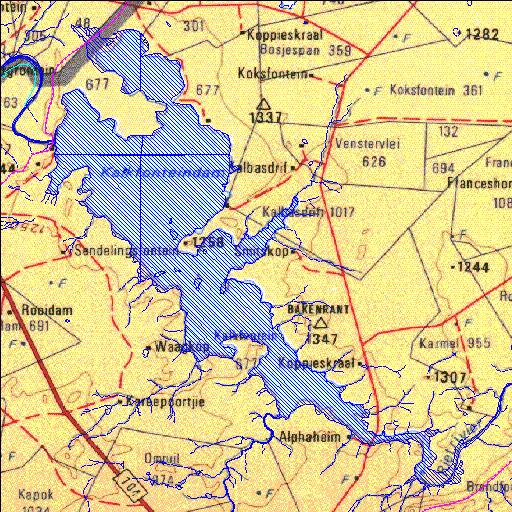
C5R002Q01
Rivs: Riet
29o32'00.4"S 25o17'15.4"E
(-29.533457, 25.287606)
Map 2925AC 2925AD 2925CA 2925CB
14746m wide x 18542m high
Cape Datum.
Surveys and Mapping.
Data from file
/iwqs3/tmp/dams/tmp/wla500-geo
| Kalkfontein (reservoir) | ||
|---|---|---|
|
|
|
|
|
Kalkfontein C5R002Q01 Rivs: Riet |
||
|
Locality: 29o32'00.4"S 25o17'15.4"E (-29.533457, 25.287606) Map 2925AC 2925AD 2925CA 2925CB 14746m wide x 18542m high Cape Datum. |
||
|
Surveys and Mapping. Data from file /iwqs3/tmp/dams/tmp/wla500-geo |
||
| <--Previous | Home^ | Next--> | |
| Resource Quality Services | stmaphtml.aml 2004-05-21 - 10:02:40 | |