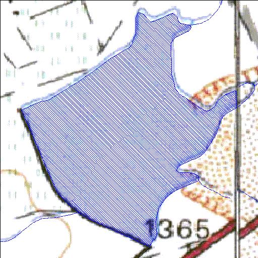
Rivs: _
30o28'07.3"S 26o29'47.4"E
(-30.468702, 26.496502)
Map 3026AD 3026BC
740m wide x 930m high
Cape Datum.
Surveys and Mapping.
Data from file
/iwqs3/tmp/dams/tmp/wla500-geo
| Klipfontein010 (reservoir) | ||
|---|---|---|
|
|
|
|
|
Klipfontein010 Rivs: _ |
||
|
Locality: 30o28'07.3"S 26o29'47.4"E (-30.468702, 26.496502) Map 3026AD 3026BC 740m wide x 930m high Cape Datum. |
||
|
Surveys and Mapping. Data from file /iwqs3/tmp/dams/tmp/wla500-geo |
||
| <--Previous | Home^ | Next--> | |
| Resource Quality Services | stmaphtml.aml 2004-05-21 - 10:26:02 | |