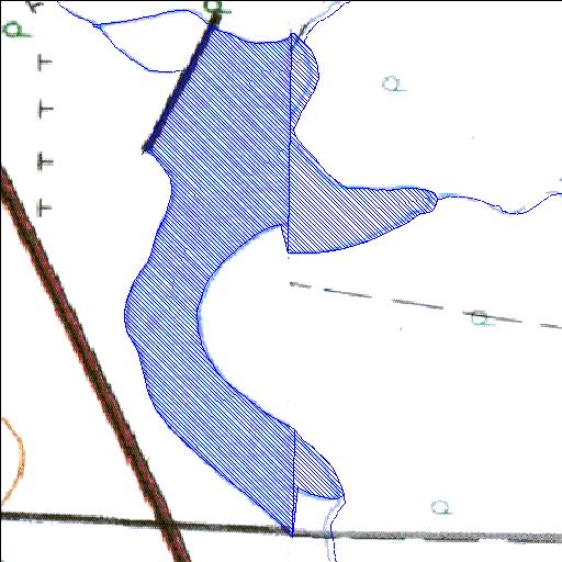
Rivs: Sedutlane
25o06'56"S 26o29'59.2"E
(-25.115561, 26.49977)
Map 2526AB 2526BA
987m wide x 1681m high
Cape Datum.
Surveys and Mapping.
Data from file
/iwqs3/tmp/dams/tmp/wla500-geo
| Kromspruit019JP (reservoir) | ||
|---|---|---|
|
|
|
|
|
Kromspruit019JP Rivs: Sedutlane |
||
|
Locality: 25o06'56"S 26o29'59.2"E (-25.115561, 26.49977) Map 2526AB 2526BA 987m wide x 1681m high Cape Datum. |
||
|
Surveys and Mapping. Data from file /iwqs3/tmp/dams/tmp/wla500-geo |
||
| <--Previous | Home^ | Next--> | |
| Resource Quality Services | stmaphtml.aml 2004-05-21 - 10:47:36 | |