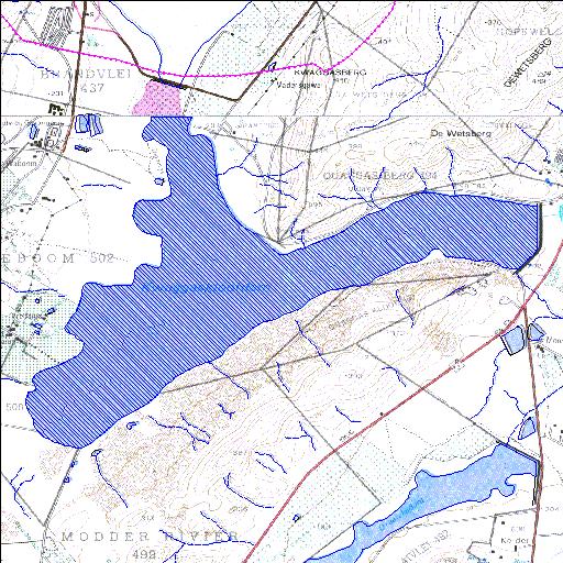
H4R004Q01
Rivs: _
33o46'16"S 19o26'24"E
(-33.771111, 19.440013)
Map 3319CB 3319CD
6619m wide x 5399m high
Cape Datum.
Surveys and Mapping.
Data from file
/iwqs3/tmp/dams/tmp/wla500-geo
| Kwaggaskloof (reservoir) | ||
|---|---|---|
|
|
|
|
|
Kwaggaskloof H4R004Q01 Rivs: _ |
||
|
Locality: 33o46'16"S 19o26'24"E (-33.771111, 19.440013) Map 3319CB 3319CD 6619m wide x 5399m high Cape Datum. |
||
|
Surveys and Mapping. Data from file /iwqs3/tmp/dams/tmp/wla500-geo |
||
| <--Previous | Home^ | Next--> | |
| Resource Quality Services | stmaphtml.aml 2004-05-21 - 10:53:04 | |