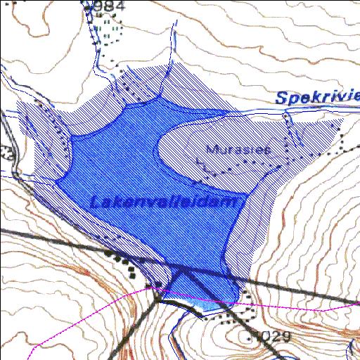
H2R002Q01
Rivs: Sanddrifskloof
33o21'32.3"S 19o34'52.6"E
(-33.358986, 19.581281)
Map 3319BC
1918m wide x 1714m high
Cape Datum.
Surveys and Mapping.
Data from file
/iwqs3/tmp/dams/tmp/wla500-geo
| Lakenvallei (reservoir) | ||
|---|---|---|
|
|
|
|
|
Lakenvallei H2R002Q01 Rivs: Sanddrifskloof |
||
|
Locality: 33o21'32.3"S 19o34'52.6"E (-33.358986, 19.581281) Map 3319BC 1918m wide x 1714m high Cape Datum. |
||
|
Surveys and Mapping. Data from file /iwqs3/tmp/dams/tmp/wla500-geo |
||
| <--Previous | Home^ | Next--> | |
| Resource Quality Services | stmaphtml.aml 2004-05-21 - 11:00:01 | |