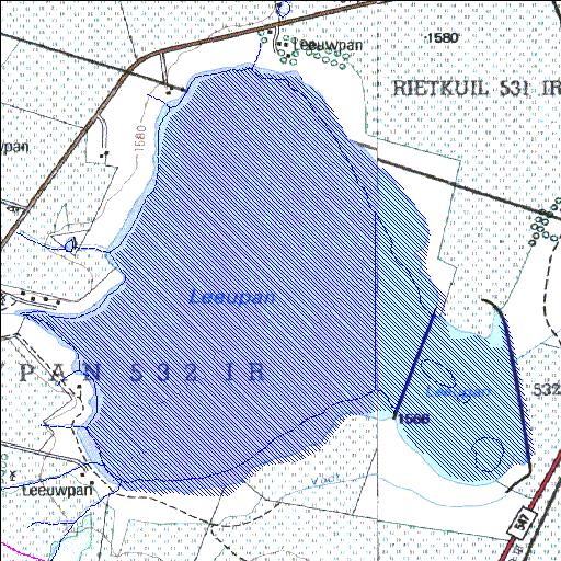
Rivs: _
26o33'40.3"S 28o59'37.5"E
(-26.561197, 28.993758)
Map 2628DB 2629CA
3660m wide x 3502m high
Cape Datum.
Surveys and Mapping.
Data from file
/iwqs3/tmp/dams/tmp/wla500-geo
| Leeupan532IR (reservoir) | ||
|---|---|---|
|
|
|
|
|
Leeupan532IR Rivs: _ |
||
|
Locality: 26o33'40.3"S 28o59'37.5"E (-26.561197, 28.993758) Map 2628DB 2629CA 3660m wide x 3502m high Cape Datum. |
||
|
Surveys and Mapping. Data from file /iwqs3/tmp/dams/tmp/wla500-geo |
||
| <--Previous | Home^ | Next--> | |
| Resource Quality Services | stmaphtml.aml 2004-05-21 - 11:05:51 | |