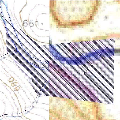
X1R005Q01
Rivs: Komati
26o04'16.5"S 31o15'03.9"E
(-26.071238, 31.251072)
Map 2631AA
1140m wide x 1048m high
Cape Datum.
Surveys and Mapping.
Data from file
/iwqs3/tmp/dams/tmp/wla500-geo
| Maguga (reservoir) | ||
|---|---|---|
|
|
|
|
|
Maguga X1R005Q01 Rivs: Komati |
||
|
Locality: 26o04'16.5"S 31o15'03.9"E (-26.071238, 31.251072) Map 2631AA 1140m wide x 1048m high Cape Datum. |
||
|
Surveys and Mapping. Data from file /iwqs3/tmp/dams/tmp/wla500-geo |
||
| <--Previous | Home^ | Next--> | |
| Resource Quality Services | stmaphtml.aml 2004-05-21 - 11:24:03 | |