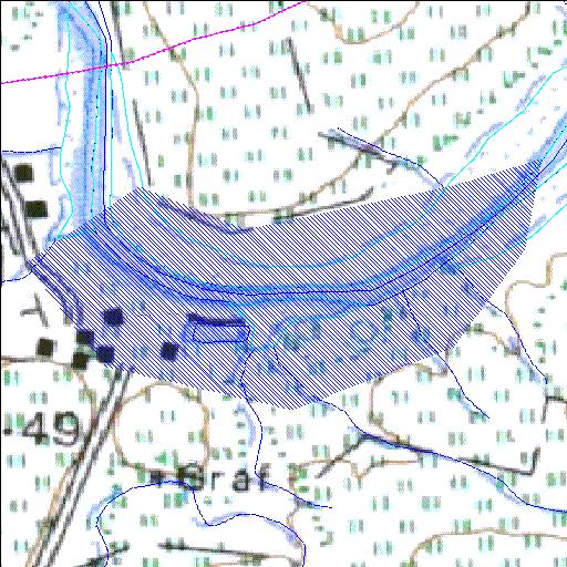
G1R003Q01
Rivs: Berg Moorreesburgspruit
33o01'43.8"S 18o47'36"E
(-33.02883, 18.793337)
Map 3318BB
978m wide x 621m high
Cape Datum.
Surveys and Mapping.
Data from file
/iwqs3/tmp/dams/tmp/wla500-geo
| Misverstand (reservoir) | ||
|---|---|---|
|
|
|
|
|
Misverstand G1R003Q01 Rivs: Berg Moorreesburgspruit |
||
|
Locality: 33o01'43.8"S 18o47'36"E (-33.02883, 18.793337) Map 3318BB 978m wide x 621m high Cape Datum. |
||
|
Surveys and Mapping. Data from file /iwqs3/tmp/dams/tmp/wla500-geo |
||
| <--Previous | Home^ | Next--> | |
| Resource Quality Services | stmaphtml.aml 2004-05-21 - 11:38:42 | |