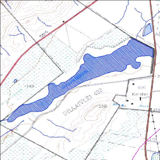
H4R001Q01
alias Draaivlei
Rivs: Hoeks
33o48'03.2"S 19o27'22.7"E
(-33.80089, 19.456294)
Map 3319CD
3281m wide x 2415m high
Cape Datum.
Surveys and Mapping.
Data from file
/iwqs3/tmp/dams/tmp/wla500-geo
| Moordkuil (reservoir) | ||
|---|---|---|
|
|
|
|
|
Moordkuil H4R001Q01 alias Draaivlei Rivs: Hoeks |
||
|
Locality: 33o48'03.2"S 19o27'22.7"E (-33.80089, 19.456294) Map 3319CD 3281m wide x 2415m high Cape Datum. |
||
|
Surveys and Mapping. Data from file /iwqs3/tmp/dams/tmp/wla500-geo |
||
| <--Previous | Home^ | Next--> | |
| Resource Quality Services | stmaphtml.aml 2004-05-21 - 11:48:39 | |