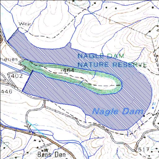
U2R002Q01
Rivs: uMngeni
29o35'28.5"S 30o38'07.5"E
(-29.591249, 30.63541)
Map 2930DA
2322m wide x 1938m high
Cape Datum.
Surveys and Mapping.
Data from file
/iwqs3/tmp/dams/tmp/wla500-geo
| Nagle (reservoir) | ||
|---|---|---|
|
|
|
|
|
Nagle U2R002Q01 Rivs: uMngeni |
||
|
Locality: 29o35'28.5"S 30o38'07.5"E (-29.591249, 30.63541) Map 2930DA 2322m wide x 1938m high Cape Datum. |
||
|
Surveys and Mapping. Data from file /iwqs3/tmp/dams/tmp/wla500-geo |
||
| <--Previous | Home^ | Next--> | |
| Resource Quality Services | stmaphtml.aml 2004-05-21 - 11:53:08 | |