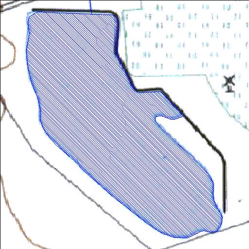
Rivs: _
29o53'58.6"S 24o33'58.7"E
(-29.899624, 24.566317)
Map 2924DC
847m wide x 1115m high
Cape Datum.
Surveys and Mapping.
Data from file
/iwqs3/tmp/dams/tmp/wla500-geo
| Nooitgedacht13 (reservoir) | ||
|---|---|---|
|
|
|
|
|
Nooitgedacht13 Rivs: _ |
||
|
Locality: 29o53'58.6"S 24o33'58.7"E (-29.899624, 24.566317) Map 2924DC 847m wide x 1115m high Cape Datum. |
||
|
Surveys and Mapping. Data from file /iwqs3/tmp/dams/tmp/wla500-geo |
||
| <--Previous | Home^ | Next--> | |
| Resource Quality Services | stmaphtml.aml 2004-05-21 - 12:05:14 | |