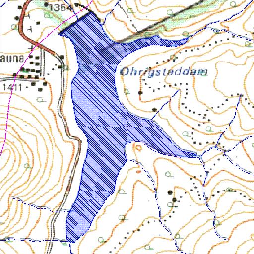
B6R001Q01
Rivs: Ohrigstad
24o56'27.4"S 30o38'10"E
(-24.94095, 30.6361)
Map 2430DC
1313m wide x 2292m high
Cape Datum.
Surveys and Mapping.
Data from file
/iwqs3/tmp/dams/tmp/wla500-geo
| Ohrigstad (reservoir) | ||
|---|---|---|
|
|
|
|
|
Ohrigstad B6R001Q01 Rivs: Ohrigstad |
||
|
Locality: 24o56'27.4"S 30o38'10"E (-24.94095, 30.6361) Map 2430DC 1313m wide x 2292m high Cape Datum. |
||
|
Surveys and Mapping. Data from file /iwqs3/tmp/dams/tmp/wla500-geo |
||
| <--Previous | Home^ | Next--> | |
| Resource Quality Services | stmaphtml.aml 2004-05-21 - 12:18:10 | |