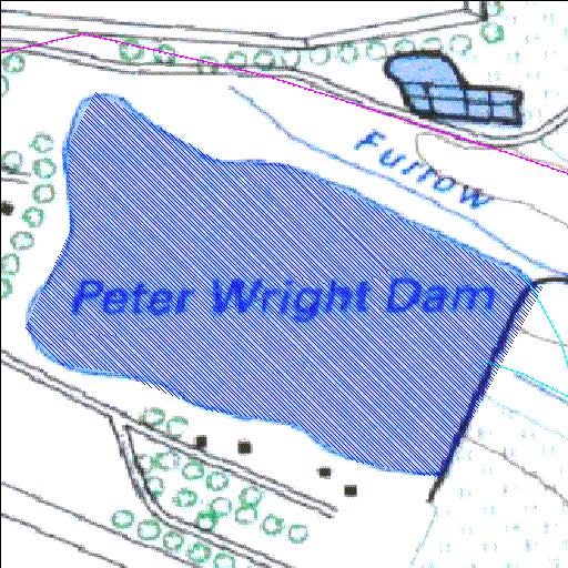
Rivs: _
26o21'42.1"S 27o43'45.8"E
(-26.361697, 27.729398)
Map 2627BC
1191m wide x 1023m high
Cape Datum.
Surveys and Mapping.
Data from file
/iwqs3/tmp/dams/tmp/wla500-geo
| Peter Wright (reservoir) | ||
|---|---|---|
|
|
|
|
|
Peter Wright Rivs: _ |
||
|
Locality: 26o21'42.1"S 27o43'45.8"E (-26.361697, 27.729398) Map 2627BC 1191m wide x 1023m high Cape Datum. |
||
|
Surveys and Mapping. Data from file /iwqs3/tmp/dams/tmp/wla500-geo |
||
| <--Previous | Home^ | Next--> | |
| Resource Quality Services | stmaphtml.aml 2004-05-21 - 12:24:54 | |