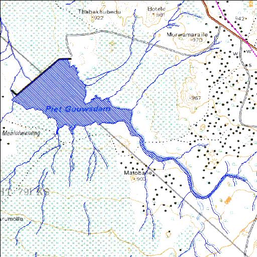
Rivs: Ngwaritsi
24o34'30.2"S 29o37'24.6"E
(-24.575062, 29.623507)
Map 2429DA
4178m wide x 2912m high
Cape Datum.
Surveys and Mapping.
Data from file
/iwqs3/tmp/dams/tmp/wla500-geo
| Piet Gouws (reservoir) | ||
|---|---|---|
|
|
|
|
|
Piet Gouws Rivs: Ngwaritsi |
||
|
Locality: 24o34'30.2"S 29o37'24.6"E (-24.575062, 29.623507) Map 2429DA 4178m wide x 2912m high Cape Datum. |
||
|
Surveys and Mapping. Data from file /iwqs3/tmp/dams/tmp/wla500-geo |
||
| <--Previous | Home^ | Next--> | |
| Resource Quality Services | stmaphtml.aml 2004-05-21 - 12:27:57 | |