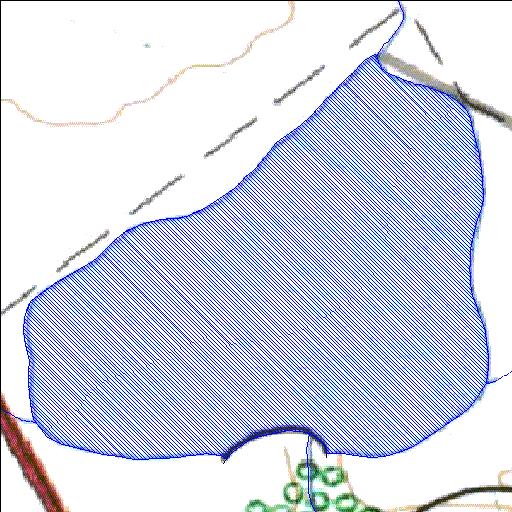
Rivs: _
29o54'48.4"S 26o46'41.6"E
(-29.913444, 26.778233)
Map 2926DD
1044m wide x 1062m high
Cape Datum.
Surveys and Mapping.
Data from file
/iwqs3/tmp/dams/tmp/wla500-geo
| Potsdam645 (reservoir) | ||
|---|---|---|
|
|
|
|
|
Potsdam645 Rivs: _ |
||
|
Locality: 29o54'48.4"S 26o46'41.6"E (-29.913444, 26.778233) Map 2926DD 1044m wide x 1062m high Cape Datum. |
||
|
Surveys and Mapping. Data from file /iwqs3/tmp/dams/tmp/wla500-geo |
||
| <--Previous | Home^ | Next--> | |
| Resource Quality Services | stmaphtml.aml 2004-05-21 - 12:33:21 | |