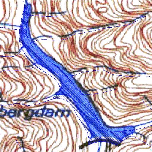
H2R001Q01
Rivs: Sanddrifskloof
33o25'55.2"S 19o34'03.1"E
(-33.432005, 19.567541)
Map 3319BC
731m wide x 1040m high
Cape Datum.
Surveys and Mapping.
Data from file
/iwqs3/tmp/dams/tmp/wla500-geo
| Roode Els (reservoir) | ||
|---|---|---|
|
|
|
|
|
Roode Els H2R001Q01 Rivs: Sanddrifskloof |
||
|
Locality: 33o25'55.2"S 19o34'03.1"E (-33.432005, 19.567541) Map 3319BC 731m wide x 1040m high Cape Datum. |
||
|
Surveys and Mapping. Data from file /iwqs3/tmp/dams/tmp/wla500-geo |
||
| <--Previous | Home^ | Next--> | |
| Resource Quality Services | stmaphtml.aml 2004-05-21 - 12:47:05 | |