Rivs: _
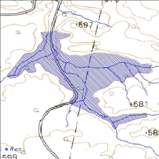
22o11'33.4"S 29o26'02.4"E
(-22.192618, 29.434001)
Map 2229AB
1799m wide x 1378m high
Cape Datum.
Surveys and Mapping.
Data from file
/iwqs3/tmp/dams/tmp/wla500-geo
| Scroda (reservoir) | ||
|---|---|---|
|
|
|
|
|
Scroda Rivs: _ |
||
|
Locality: 22o11'33.4"S 29o26'02.4"E (-22.192618, 29.434001) Map 2229AB 1799m wide x 1378m high Cape Datum. |
||
|
Surveys and Mapping. Data from file /iwqs3/tmp/dams/tmp/wla500-geo |
||
| <--Previous | Home^ | Next--> | |
| Resource Quality Services | stmaphtml.aml 2004-05-21 - 13:05:16 | |