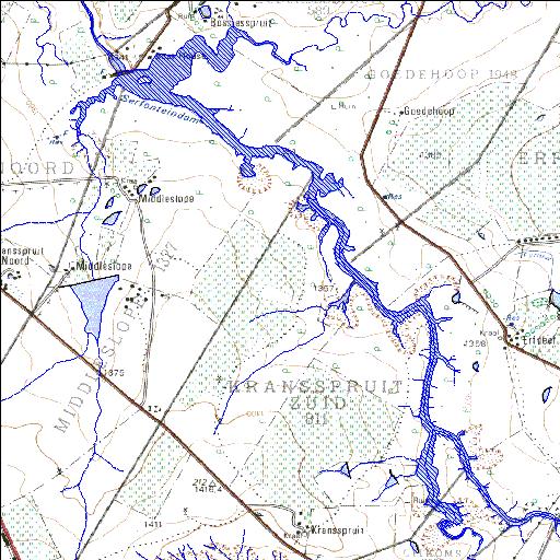
C6R002Q01
Rivs: Randjiespruit Vals
27o43'18.6"S 27o19'01.4"E
(-27.721835, 27.317057)
Map 2727CB
4396m wide x 5907m high
Cape Datum.
Surveys and Mapping.
Data from file
/iwqs3/tmp/dams/tmp/wla500-geo
| Serfontein (reservoir) | ||
|---|---|---|
|
|
|
|
|
Serfontein C6R002Q01 Rivs: Randjiespruit Vals |
||
|
Locality: 27o43'18.6"S 27o19'01.4"E (-27.721835, 27.317057) Map 2727CB 4396m wide x 5907m high Cape Datum. |
||
|
Surveys and Mapping. Data from file /iwqs3/tmp/dams/tmp/wla500-geo |
||
| <--Previous | Home^ | Next--> | |
| Resource Quality Services | stmaphtml.aml 2004-05-21 - 13:06:59 | |