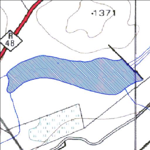
Rivs: _
30o25'00.1"S 24o29'38.8"E
(-30.416698, 24.494106)
Map 3024AD 3024BC
1399m wide x 571m high
Cape Datum.
Surveys and Mapping.
Data from file
/iwqs3/tmp/dams/tmp/wla500-geo
| Slingersfontein186 (reservoir) | ||
|---|---|---|
|
|
|
|
|
Slingersfontein186 Rivs: _ |
||
|
Locality: 30o25'00.1"S 24o29'38.8"E (-30.416698, 24.494106) Map 3024AD 3024BC 1399m wide x 571m high Cape Datum. |
||
|
Surveys and Mapping. Data from file /iwqs3/tmp/dams/tmp/wla500-geo |
||
| <--Previous | Home^ | Next--> | |
| Resource Quality Services | stmaphtml.aml 2004-05-21 - 13:13:59 | |