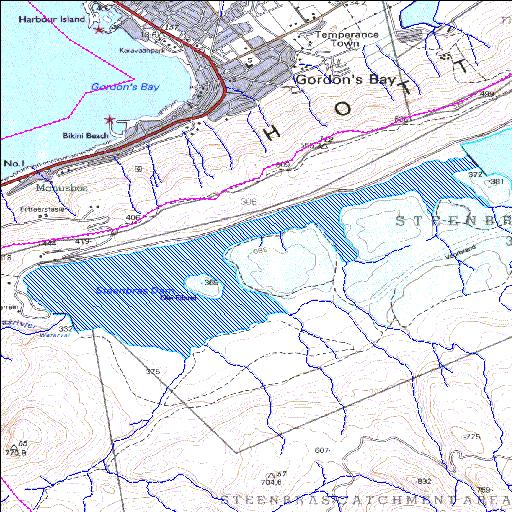
G4R001Q01
Rivs: Steenbras
34o10'47"S 18o52'35"E
(-34.179733, 18.876392)
Map 3418BB
5755m wide x 3391m high
Cape Datum.
Surveys and Mapping.
Data from file
/iwqs3/tmp/dams/tmp/wla500-geo
| Steenbras (Lower) (reservoir) | ||
|---|---|---|
|
|
|
|
|
Steenbras (Lower) G4R001Q01 Rivs: Steenbras |
||
|
Locality: 34o10'47"S 18o52'35"E (-34.179733, 18.876392) Map 3418BB 5755m wide x 3391m high Cape Datum. |
||
|
Surveys and Mapping. Data from file /iwqs3/tmp/dams/tmp/wla500-geo |
||
| <--Previous | Home^ | Next--> | |
| Resource Quality Services | stmaphtml.aml 2004-05-21 - 13:21:08 | |