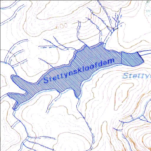
H1R002Q01
Rivs: Holsloot
33o50'19.9"S 19o14'38.8"E
(-33.838871, 19.244113)
Map 3319CC 3319CD
1778m wide x 1153m high
Cape Datum.
Surveys and Mapping.
Data from file
/iwqs3/tmp/dams/tmp/wla500-geo
| Stettynskloof (reservoir) | ||
|---|---|---|
|
|
|
|
|
Stettynskloof H1R002Q01 Rivs: Holsloot |
||
|
Locality: 33o50'19.9"S 19o14'38.8"E (-33.838871, 19.244113) Map 3319CC 3319CD 1778m wide x 1153m high Cape Datum. |
||
|
Surveys and Mapping. Data from file /iwqs3/tmp/dams/tmp/wla500-geo |
||
| <--Previous | Home^ | Next--> | |
| Resource Quality Services | stmaphtml.aml 2004-05-21 - 13:24:31 | |