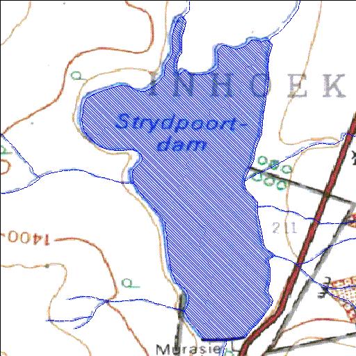
Rivs: Sanddrifspruit
30o31'50.2"S 26o36'13.3"E
(-30.530604, 26.603693)
Map 3026DA
1015m wide x 1868m high
Cape Datum.
Surveys and Mapping.
Data from file
/iwqs3/tmp/dams/tmp/wla500-geo
| Strydpoort (reservoir) | ||
|---|---|---|
|
|
|
|
|
Strydpoort Rivs: Sanddrifspruit |
||
|
Locality: 30o31'50.2"S 26o36'13.3"E (-30.530604, 26.603693) Map 3026DA 1015m wide x 1868m high Cape Datum. |
||
|
Surveys and Mapping. Data from file /iwqs3/tmp/dams/tmp/wla500-geo |
||
| <--Previous | Home^ | Next--> | |
| Resource Quality Services | stmaphtml.aml 2004-05-21 - 13:26:45 | |