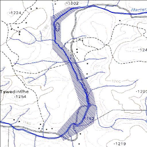
C3R006Q01
Rivs: Harts
27o31'22.7"S 24o51'09.9"E
(-27.522976, 24.852738)
Map 2724DB
1290m wide x 3619m high
Cape Datum.
Surveys and Mapping.
Data from file
/iwqs3/tmp/dams/tmp/wla500-geo
| Taung (reservoir) | ||
|---|---|---|
|
|
|
|
|
Taung C3R006Q01 Rivs: Harts |
||
|
Locality: 27o31'22.7"S 24o51'09.9"E (-27.522976, 24.852738) Map 2724DB 1290m wide x 3619m high Cape Datum. |
||
|
Surveys and Mapping. Data from file /iwqs3/tmp/dams/tmp/wla500-geo |
||
| <--Previous | Home^ | Next--> | |
| Resource Quality Services | stmaphtml.aml 2004-05-21 - 13:33:52 | |