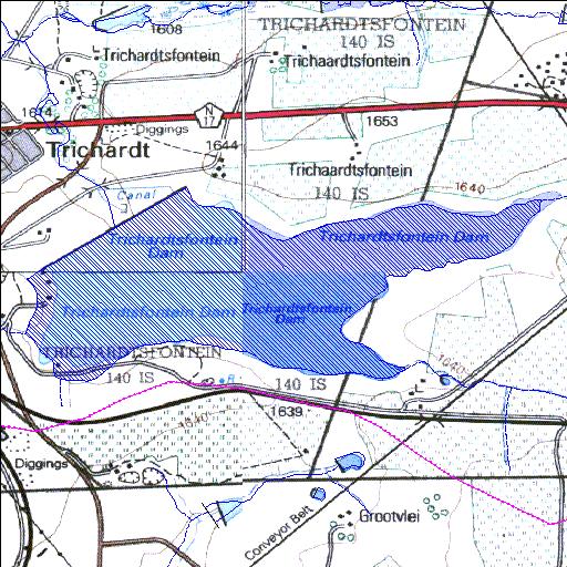
B1R999Q01
Rivs: _
26o30'02.7"S 29o15'09.6"E
(-26.500747, 29.252663)
Map 2629AC 2629AD 2629CA 2629CB
3623m wide x 1746m high
Cape Datum.
Surveys and Mapping.
Data from file
/iwqs3/tmp/dams/tmp/wla500-geo
| Trichardsfontein (reservoir) | ||
|---|---|---|
|
|
|
|
|
Trichardsfontein B1R999Q01 Rivs: _ |
||
|
Locality: 26o30'02.7"S 29o15'09.6"E (-26.500747, 29.252663) Map 2629AC 2629AD 2629CA 2629CB 3623m wide x 1746m high Cape Datum. |
||
|
Surveys and Mapping. Data from file /iwqs3/tmp/dams/tmp/wla500-geo |
||
| <--Previous | Home^ | Next--> | |
| Resource Quality Services | stmaphtml.aml 2004-05-21 - 13:41:04 | |