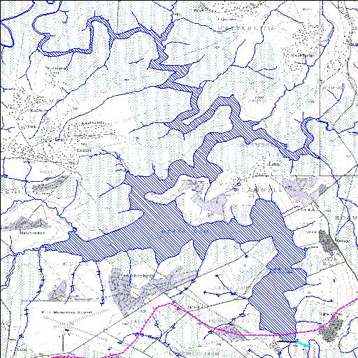
T2R001Q01
Rivs: Mtata
31o30'04"S 28o42'24.5"E
(-31.501098, 28.706811)
Map 3128BC 3128BD 3128DA 3128DB
9262m wide x 12318m high
Cape Datum.
Surveys and Mapping.
Data from file
/iwqs3/tmp/dams/tmp/wla500-geo
| Umtata (reservoir) | ||
|---|---|---|
|
|
|
|
|
Umtata T2R001Q01 Rivs: Mtata |
||
|
Locality: 31o30'04"S 28o42'24.5"E (-31.501098, 28.706811) Map 3128BC 3128BD 3128DA 3128DB 9262m wide x 12318m high Cape Datum. |
||
|
Surveys and Mapping. Data from file /iwqs3/tmp/dams/tmp/wla500-geo |
||
| <--Previous | Home^ | Next--> | |
| Resource Quality Services | stmaphtml.aml 2004-05-21 - 13:50:35 | |