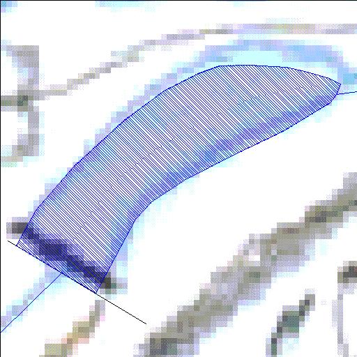
M2R001Q01
Rivs: Van_Stadens
33o51'08.2"S 25o13'28.2"E
(-33.852282, 25.22451)
Map 3325CC
215m wide x 189m high
Cape Datum.
Surveys and Mapping.
Data from file
/iwqs3/tmp/dams/tmp/wla500-geo
| Van Stadens - Upper (reservoir) | ||
|---|---|---|
|
|
|
|
|
Van Stadens - Upper M2R001Q01 Rivs: Van_Stadens |
||
|
Locality: 33o51'08.2"S 25o13'28.2"E (-33.852282, 25.22451) Map 3325CC 215m wide x 189m high Cape Datum. |
||
|
Surveys and Mapping. Data from file /iwqs3/tmp/dams/tmp/wla500-geo |
||
| <--Previous | Home^ | Next--> | |
| Resource Quality Services | stmaphtml.aml 2004-05-21 - 14:03:14 | |