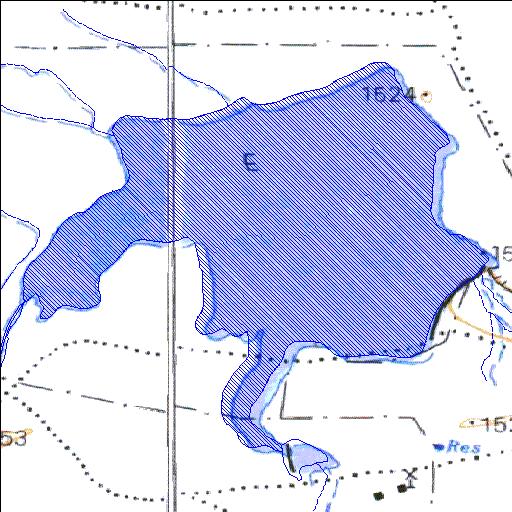
Rivs: Seekoei
31o29'09"S 24o15'11.9"E
(-31.485834, 24.253297)
Map 3124AC 3124AD
1831m wide x 1831m high
Cape Datum.
Surveys and Mapping.
Data from file
/iwqs3/tmp/dams/tmp/wla500-geo
| Welgelegen74W (reservoir) | ||
|---|---|---|
|
|
|
|
|
Welgelegen74W Rivs: Seekoei |
||
|
Locality: 31o29'09"S 24o15'11.9"E (-31.485834, 24.253297) Map 3124AC 3124AD 1831m wide x 1831m high Cape Datum. |
||
|
Surveys and Mapping. Data from file /iwqs3/tmp/dams/tmp/wla500-geo |
||
| <--Previous | Home^ | Next--> | |
| Resource Quality Services | stmaphtml.aml 2004-05-21 - 14:23:10 | |