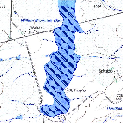
Rivs: Klein-Xspruit
26o27'31.7"S 29o55'20.3"E
(-26.458818, 29.922303)
Map 2629BD
1401m wide x 3673m high
Cape Datum.
Surveys and Mapping.
Data from file
/iwqs3/tmp/dams/tmp/wla500-geo
| Willem Brummer (reservoir) | ||
|---|---|---|
|
|
|
|
|
Willem Brummer Rivs: Klein-Xspruit |
||
|
Locality: 26o27'31.7"S 29o55'20.3"E (-26.458818, 29.922303) Map 2629BD 1401m wide x 3673m high Cape Datum. |
||
|
Surveys and Mapping. Data from file /iwqs3/tmp/dams/tmp/wla500-geo |
||
| <--Previous | Home^ | Next--> | |
| Resource Quality Services | stmaphtml.aml 2004-05-21 - 14:28:31 | |