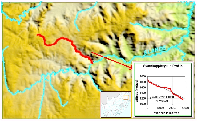
This example shows a river profile for the Swartkoppiespruit in Mpumalanga. Moolman (unpublished results) used the Arc/Info GRID application to calculate the profile of this river from the national digital elevation model. This technique is rapid, but the 200 to 400 metre grid resolution places a limit on its accuracy.