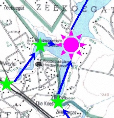
Often, the original topographic map blue plate has gaps in the river course where dams and bridges are located. The GIS operator needs to manually close these gaps. The image shows a node that the operator has inserted to continue the Pienaars River and Hartebees Spruit through Roodeplaat Dam.