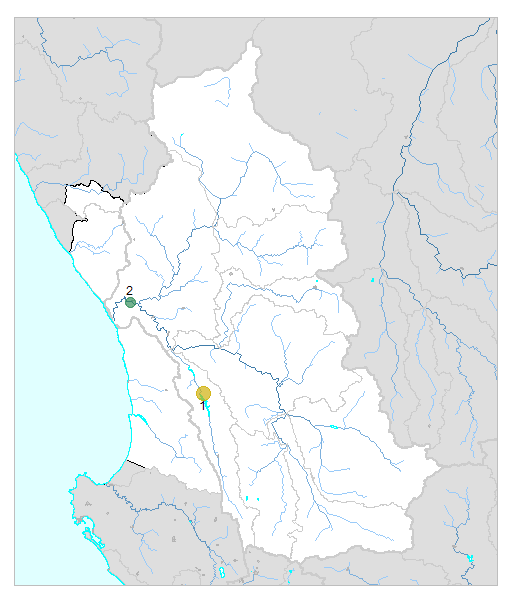
№ | Site [ view Olifants/Doorn sites in Google Earth ] |
Plot all data | Date | MPN, or cfu / 100mL |
Turb. NTU |
pH | Temp. oC |
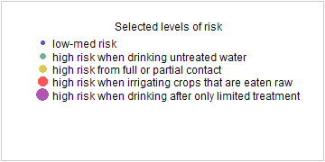
Risk based on E. coli if recorded, otherwise on faecal coliforms | ||||
---|---|---|---|---|---|---|---|---|---|---|---|---|
E. coli | faecal coliforms | drinking- no treatment |
drinking- limited treatment |
full or partial contact |
irrigation- crops eaten raw |
|||||||
1 | 188148 [2-month plot]
JDMC002 - Clanwilliam at Road Bridge D/S of WWTW Outfall on Jan Dissels River |
![]() |
2021-05-11 | 1200 | 4000 | - | 6.5 | - | HIGH | low | HIGH | Med |
1 | 188148 | 2021-06-09 | 210 | 520 | - | 6.0 | - | HIGH | low | Med | low | |
2 | 190407 [2-month plot]
ODMC003- Lutzville at Low Water Bridge on Olifantsrivier |
![]() |
2021-05-18 | 540 | 860 | - | 7.8 | - | HIGH | low | HIGH | low |
2 | 190407 | 2021-06-07 | 240 | 380 | - | 7.9 | - | HIGH | low | Med | low |
![]() |
![]() |